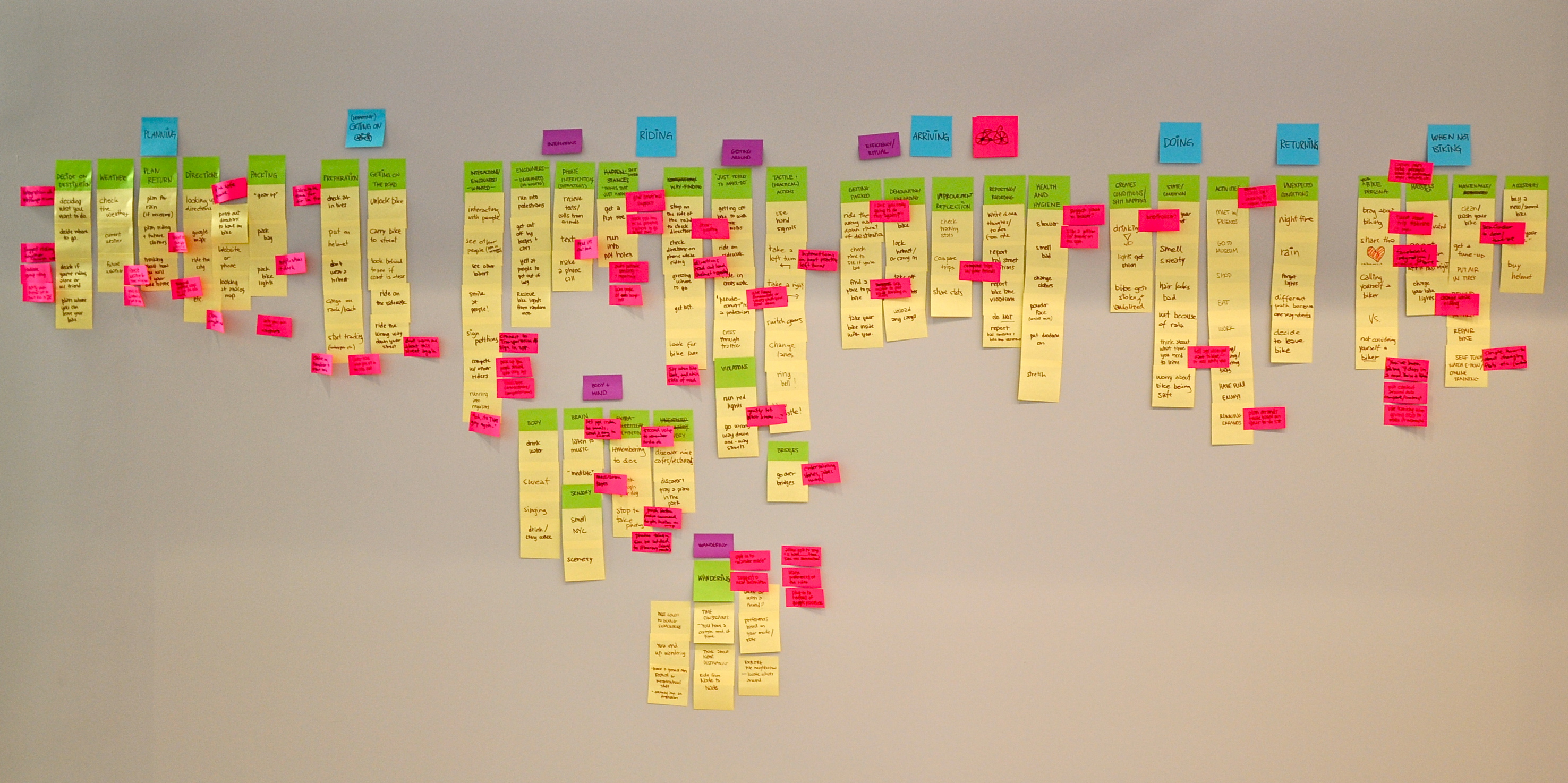
Wandering

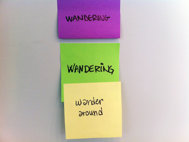
Following up on Frank Chimero’s suggestion about having two buttons – one to get lost, and one to not get lost, we’ve been thinking a bit about the possibility to encourage wandering and discovering new areas with your bike. When we did our post-it analysis last week, we tried our best to make sure we emphasized this opportunity by making a high level purple category for it:

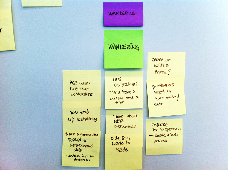
But then we realized, as much as we like this feature, neither Carrie or I are often “getting lost” on purpose with our bikes. We mainly ride from A to B, and try our best to not take any detours. We might simply not be the target audience for such a feature, and have no real insight into how the “bike wanderers” behave. So we went around to ask our classmates if they possibly could fill us in… All of a sudden the Wandering category had a lot more content:

From this we learnt two things; something about wandering specifically, but also something about our process. We need to talk to people sooner rather than later – let’s do some interviews!

Biking and politics

Ben Adler’s article The Rise of Urban Biking in The Nation describes some interesting political views on biking in America. Why is it that bike lanes are more supported by the democrats than the republicans? Is supporting a more bike friendly city mainly about supporting Williamsburg hipsters’ image?

Still, the perception that cycling advocates are elitist has been exploited politically. Conservatives who dismiss smart-growth advocacy as the work of out-of-touch liberals who don’t realize that Americans will never get out of their cars have ramped up their criticisms to the point of demagogy, painting the complete streets movement as a scheme to turn red-blooded Americans into socialists. Last year, Colorado’s Republican gubernatorial nominee, Dan Maes, attacked his Democratic opponent, Denver’s mayor, John Hickenlooper, for building bike lanes, warning that they “could threaten our personal freedoms” and “convert Denver into a United Nations community.” Hickenlooper won.
(Ben Adler, The Rise of Urban Biking)

Features

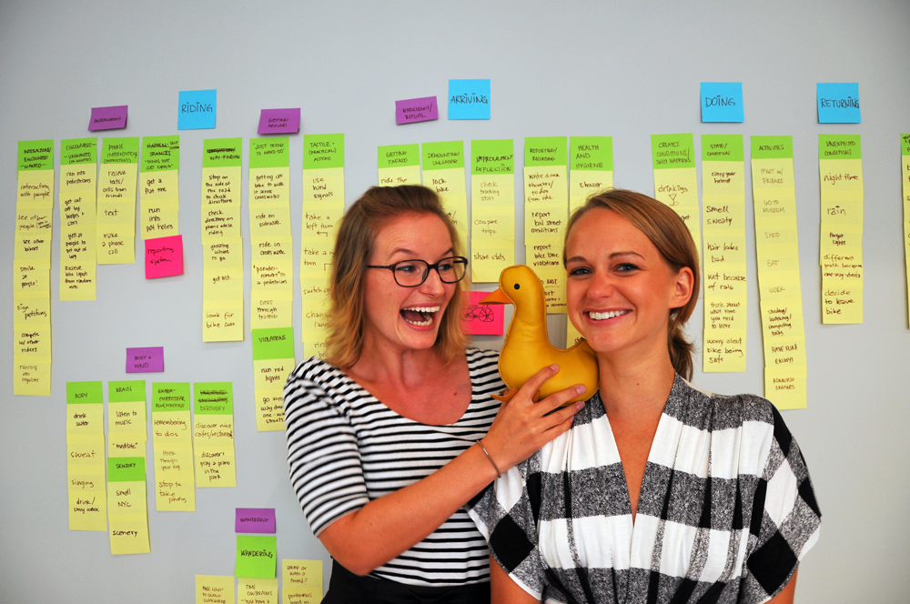
To sort all thoughts and ideas that we’ve had around urban biking lately, we decided to do an analysis. We got all our thinking around the bike ride up on the wall, categorized it, and then tried to identify features that could be a part of our thesis product. It took most of today to map our thoughts to the wall, and we took a photo shoot break somewhere in the middle of it all:

The wall ended up covered in post-its, and we’ve made a separate blog entry listing the content just to document it. We continued to work with the opportunities identified on Monday, trying to find some common themes, and to decide what fits into the core of our concept, what are nice-to-haves, and which features we can leave behind.

Here are our features grouped:


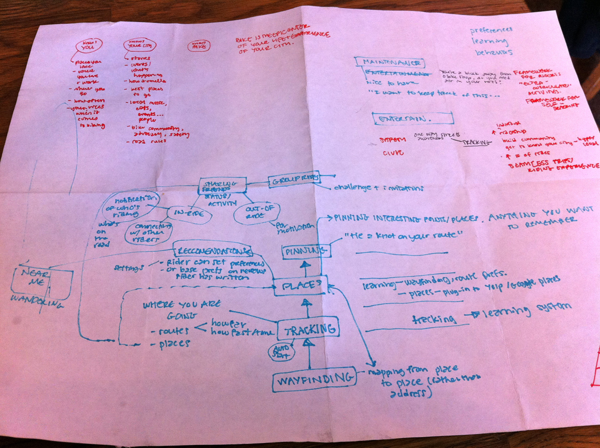
Then we escaped the studio, took a quick bike ride to a café we’ve wanted to visit for a while – Tea & Sympathy. Over a cup of tea and some bangers and mash we discussed the key features of our product. Here are our notes from that chat:

We will publish a more polished concept map later. But from working with this material for while it’s clear that Wayfinding is our core, and that Tracking is in a good second place, followed by integration to some Location Service like Yelp or Google Places. We’re also quite interested in exploring the Group Ride aspect. If we list all the feature groups we have identified through this exercise, this might be our list somewhat prioritized:

Wayfinding
Tracking
Personalization/discovery/places
Group ride
Social
Character
Not going from A to B
Maintenance
Safety
Civic engagement
Sharing/advocacy
Entertainment
Socialize with strangers
Weather
Need mic
Need GPS
Commercial

We will narrow this down, but as long as we know our focus, we’re one step closer to an awesome product. Yeah!

Context Map and Opportunities


[—] PLANNING

[—] Decide on destination
Deciding what to do
Decide where to go
Decide if riding alone or with friend
Plan where you can leave your bike

[—] Opportunities
Integration with Yelp/Google Places
Suggest riding together through app
Facilitate group riding
Notify when your friends get on their bike to meet you
Play local music from bands performing this week

[—] Weather
Check the weather
Current weather
Future weather

[—] Opportunities
Forecast the weather for when your riding home
Group poll on whether it will rain or not

[—] Plan return
Plan for rain
Plan riding + future clothes
Thinking about how you will get your bike home

[—] Opportunities
Suggest best rain gear
Provide opportunity to buy from app
Suggest creative ways to get the bike home if it rains

[—] Directions
Looking up directions
Google maps
Ride the city
Etc
Print out directions to have on bike
Look at analog map
Website or phone

[—] Opportunities
Find safe route
Change suggested route
Write your own route (waypoints)

[—] Packing
Gear up
Pack bag
Pack bike lights

[—] Opportunities
Notifications if dark

[—] DEPARTING

[—] Preparation
Check air in tires
Put on helmet
Don’t wear a helmet
Put your helmet on your bag
Cargo on rack
Start tracking

[—] Opportunities
Calculate time for air in tires
Autotrack when you sit on the bike seat
Autotrack by using sensor in helmet
Device on handlebar to start tracking

[—] Getting on the road
Unlock bike
Carry bike to street
Look behind to see if coast is clear
Ride on sidewalk
Ride the wrong way down your street

[—] Opportunities
Say “Don’t warn me about this street again”

[—] RIDING

[—] INTERRUPTIONS
[—] Interactions/encounters wanted
Interacting with people
Talking with people on the sidewalk
See other people in the neighborhood
See other bikers
Smile at people
Sign petitions
Compete with other riders
Run into regulars

[—] Opportunities
Connect to Transportation Alternatives (Sign petitions in app)
Pick up the people around you using the app
Facilitate conversation/competitiveness
“Oh, it’s that guy again!”

[—] Interactions/encounters unwanted
Run into pedestrians
Get cut off buy buses/cars
Yell at people to get out of the way
Receive bike lights from random men

[—] Opportunities
Report stories and funny encounters

[—] Phone interventions/distractions
Receive text/calls from friends
Make a phone call
Text

[—] Opportunities
Read SMS out loud
Make a phone call (mic in helmet)

[—] Shit happens
Get a flat tire
Run into potholes

[—] Opportunities
Give emotional support
Teach people how to fix tire (video/text manual)
Where to get tire fixed
Auto pothole sensing and reporting

[—] GETTING AROUND
[—] Way-finding
Stop on the side of the road to check directions
Check directions while riding
Guessing where to go
Get lost
Look for bike lane

[—] Opportunities
Directions read out loud (helmet + speaker)
Say when bike lane, and which side of the road it’s on

[—] Violations/Just trying to make do
Getting off the bike to walk it across crosswalks
Ride on sidewalk
Ride on crosswalk
Pseudo-convert to a pedestrian
Cross through traffic
Run red lights
Go wrong way down one-way streets

[—] OpportunitiesGive funny commentary or stories when you slow down
Gently let biker know about the violation…?
Safety nudge: “Hey, did you know you’re not supposed to do that?”

[—] Tactile/practical actions
Use hand signals
Take a left turn
Take a right turn
Switch gears
Change lanes
Ring bell
Blow whistle

[—] Opportunities
Instructions on best-practice
Ooops, illegal to take right turn on red in NY

[—] Bridges
Go over bridges

[—] Opportunities
Give funny commentary, stories, music when you slow down
Nudge person to thank safety guys on the bridge

[—] BODY+MIND
[—] Body
Drink water
Sweat
Sing
Drink / carry coffee

[—] Brain
Listen to music
Meditate

[—] Opportunities
Let people listen to music
Send a song to a friend
Meditation tapes

[—] Sensory
Smell NYC
Scenery

[—] Opportunities
Commentary on scenery

[—] Remembering
Remebering to-dos
Think through your day
Stop to take photos

[—] Opportunities
Record voice to remember to-dos etc
Push button/voice command to pin locations to map
Photos taken can be added to itinerary (visual route)

[—] WANDERING
[—] Wandering
Bike lends to going somewhere
You end up wandering
Have a general aim (festival/hood/concert/museum)
Journey as important as destination
Time constraints/window
Think about near destinations
Ride from node to node
Along or with a friend
Preferences based on your mode or state of being
Explore the neighborhood/locate what’s around

[—] Opportunities
Opt in to “wander mode”
Suggest a near destination
Allow people to say “I have _____ time, take me somewhere”
Learn preferences of the rider
Plug into reviews of Google Places etc

[—] ARRIVING

[—] EFFICIENCY/RITUAL
[—] Getting parked
Ride the wrong way down the street of destination
Check time to see if you’re late
Find a place to park bike
Take your bike inside with you

[—] Opportunities
“Are you really going to do this again?”
Ask mayor to put bike parking in certain places

[—] Demounting/Unloading
Lock bike
Lock helmet/Carry helmet in
Take off helmet and bike lights
Unload any cargo

[—] Improvement/Reflection
Check tracking stats
Compare trips
Share stats

[—] Opportunities
Compare trips with your friends

[—] Reporting/recording
Write down thoughts/to-dos from ride
Report bad street conditions
Report bike lane violations
Do not report

[—] Opportunities
Facilitate reporting
Offering incentives for reporting

[—] Health and hygiene
Shower
Smell bad
Change clothes
Powder face
Put deodorant on
Stretch

[—] Opportunities
Suggest places to shower
Sign a petition for showers on the spot
Support a cultural shift of smelling bad

[—] DOING

[—] Creates conditions/shit happens
Drinking
Lights get stolen
Bike get stolen/vandalized

[—] Opportunities
Breathalizer

[—] States/Conditions
Carry your helmet
Smell sweaty
Hair looks bad
Wet because of rain
Think about when you need to leave
Worry about bike being safe

[—] Opportunities
Tell app when you need to leave – it will notify you
Baby monitor bike

[—] Activities
Meet with friends
Go to museum
Shop
Eat
Work
Study
Complete tasks
Run errands

[—] Opportunities
Favorite places log
Checking in (integrate with foursqaure?)
Plan errands route based on your to-do list

RETURNING
[—] Unexpected conditions
Night time
Rain
Forgot lights
Different path home because one-way streets
Decide to leave bike

[—] Opportunities
Reminder of where you left bike

[—] WHEN NOT BIKING

[—] Your bike persona
Brag about biking
Share the love, Advocate biking
Call yourself a biker
vs. Not considering yourself a biker

[—] Opportunities
Rewards for doing a certain amount of rides, give honorary titles
You have biked for 7 days in a row! You are a biker!
capture rider biking persona based on preferences, style, behavior, etc.
Tweet about you trips to #BikeNYC, target stories to specific people
Facebook integration and sharing (FB timeline)
Put context around data (compare and contrast)
Use variety when giving stats, make it meaningful

[—] Hassles
Trying to be motivated
Go get bike from where you left it the previous night
Charge your bike lights, replace batteries or light itself

[—] Opportunities
Charge lights or helmet while riding

[—] Maintenance
Clean your bike
Get a tune-up
Put air in tires
Remind friends to put air in tires
Repair bike
Self-teach, watch e-how, online training

[—] Opportunities
Simple how-to about changing flats
Reminder to clean or get tune-up

[—] Accessories
Buy a new or second bike
Pimp your bike
Buy a helmet

Flagged areas, Areas we feel there is more to be explored
Going over bridges (site specific encouragement and commentary)
Wandering
Bike sharing
Motivation and data
Learning rider preferences, Pinning places on the map
Communicating with and riding with friends
Bikers and the rules of the road

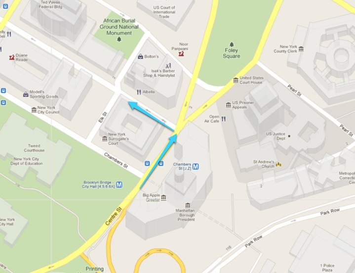
Carrie and I have been talking a lot about traffic rules lately, and how we sometimes need to bend them to feel safer when biking in high traffic. Sometimes it feels so dangerous to take a left turn in a high-trafficked intersection, that we might ride a bit before the light turns green, because that’s the only time we can turn left without angry cars driving on all sides, and paralyzing us in the middle of the intersection. The Centre street / Reade street section right after the Brooklyn Bridge is one of those:

Tony Wessling a.k.a. The Upright Biker writes an interesting post about the subject of where the bikers fit into the traffic hierarchy, Bicyclists are not above the law – we’re below it. He states that the laws generally favor cars over bikers, even though we all pay for this infrastructure. When it comes to the red lights specifically, his philosophy is this:

Traffic lights, in addition to adding safety for motorists, cyclists, and pedestrians, are designed to regulate the flow of automobiles. The flow of bicycles does not really need much regulation at this point, so if there’s no danger, off I go. Once there are so many bikes on the road that their movement needs regulation, I’ll gladly stop. Did it in Amsterdam. Would do it in Copenhagen.
The Upright Biker

Bikers are different than cars, and we need to be very aware of that when designing our product. We can’t necessarily expect the biker to follow ALL rules at all times. We want our users to be safe on the bike, but sometimes safety and the rules of the road simply don’t match up.

Thesis Proposal

Elevator pitch:

It’s your bike’s better half. It knows you, your bike, and the city you live in. It offers you a seamless and enriched riding experience through giving you turn by turn directions, tracking your behavior, advising you on how to take care of your bike, and suggesting you destinations and routes that suit your taste.

Intended audience:
Intermediate riders
People currently biking in the city. They might already use navigational tools like bike maps and apps, and are searching for new ways to make their trips more seamless whether they want to get from A to B or wander.

Beginner riders
There’s a difference between knowing how to ride a bike, and being confident riding in an urban environment. Beginner riders might use their bike for recreational trips and are not yet convinced that biking can be a viable transit option.

Tourists on bikes
People that want to explore a new city from the bike seat. Might rent bikes from bike shops, or using bike share programs.

Context of project:
The bike community
Open Plans
Bike sharing program
Ride the City
Transportation Alternatives
New York City DOT
Bike Tech Meetup
Bike activists (bloggers, political figures, …)

Bike Tools
Biking apps that track behavior
Biking apps aiding navigation
Bike computers for pro cyclists
GPS for bikers (TOM TOM has turn by turn voice directions in Europe)

Products with related concepts
Motivational, data sharing, storytelling, creative personalities, way finding, trip planning, etc.
Websites and apps: Weight Watchers, RunKeeper, Nike+, Daytum, OpenTripPlanner, TripAdvisor, Yelp, Tamagotchi etc.

Intended Experience/Form:
Experience
A friendly and delightful product that is aware of what the biker needs and when.
It alleviates stress from biking in chaotic surroundings.
It inspires discovery of new places.
It eases the process of using your bike for transit.

Form
App + physical component (talking helmet, vibrating handlebars, blinking lights, …)

Plan & Next Steps:
Our overall goal is to create a working prototype that lets people experience the core concepts early on, and iterate the concept from there.

Our next steps (2 week perspective):

  • Create a journey map
    Zoom out and identify pain points and opportunities within the area of urban biking.
  • Create a conceptual model of project
    We narrow in on a concept suitable for our thesis.
  • Develop an MVP
    Software: Creating a web app for a user to input start and end point, and get directions through voice.
    Hardware: R&D for speakers, bluetooth, button, sensors, and connecting these pieces to each other and the app.
  • Do contextual research
    What’s out there? Dig deeper than the list above. Divide and conquer.

Alternative elevator pitch:

We’re making a digital bike companion to be used by urban peddlers to alleviate them of the stress of navigation in a heavy trafficked, stressful environment. Enabling people to experience the city seamlessly from the bike seat, offering directions, tracking, bike maintenance advice, and tips for urban destinations.

The Google Directions API

The Google Directions API is a service that calculates directions between locations using an HTTP request.

Note the following:

This service is generally designed for calculating directions for static (known in advance) addresses for placement of application content on a map; this service is not designed to respond in real time to user input, for example. For dynamic directions calculations (for example, within a user interface element), consult the documentation for the JavaScript API V3 Directions Service.

Still, by using the Google Directions API, you can get directions through putting URLs into the address bar on JSON or XML format. Here are som tests:

Home to Purpose:
http://maps.googleapis.com/maps/api/directions/json?origin=519+5th+st,+brooklyn,NY&destination=224+centre+st,NY&mode=bicycling&sensor=false

Home to Purpose – via Brooklyn bridge using waypoints:
http://maps.googleapis.com/maps/api/directions/json?origin=519+5th+st,+brooklyn,NY&destination=224+centre+st,NY&waypoints=brooklyn+bridge,NY&mode=bicycling&sensor=false
…though this breaks the route into two legs, and the directions says “destination will be on your left” also when I’m on Brooklyn Bridge…

Home to Purpose – alternative routes:
http://maps.googleapis.com/maps/api/directions/json?origin=519+5th+st,+brooklyn,NY&destination=224+centre+st,NY&alternatives=true&mode=bicycling&sensor=false

XML instead of json (json is recommended though):
http://maps.googleapis.com/maps/api/directions/xml?origin=519+5th+st,+brooklyn,NY&destination=224+centre+st,NY&mode=bicycling&sensor=false

This was the service I used when getting directions for the Low-fi prototyping, part II, which I then turned into a text file ready to be read by the guy from Speak It!

Some issues:

  • The directions do not seem to have information about bike path/lane in Google Maps. The Ride the City app does have this information.
  • For knowing the user’s current location, we might need to use the Official Google JavaScript API.

Low-fi prototyping, part II

After our last prototyping test suffered from bad sound quality from phone to phone, I figured it would be good to test audio coming from my own phone. I made a text file with directions to read. Then I let this charming British man in the app SpeakIt! read it out loud. Here’s the Speak it! audio file.

The file is one long file with text-to-speech directions read on this format:

1. Head southeast on 5th Street toward 8th Ave.
Ride about 282 feet.
Then turn left onto 8th Ave

2. Turn left onto 8th Ave
Ride about 0.1 miles.
Then turn left onto 2nd Street

3. Turn left onto 2nd Street
Ride about 0.4 miles.
Then turn right onto 5th Ave

4. Turn right onto 5th Ave
Ride about 0.6 miles.
Then turn left onto Bergen Street

5. Turn left onto Bergen Street
Ride about 0.5 miles.
Then turn right onto Bond Street

6. Turn right onto Bond Street
Ride about 253 feet.
Destination will be on the left
Address: 190 Dean Street

I tested it with Apple headphones (one plug in) and iPhone, using the remote on the headphones to pause after each bulk of directions. Of course I needed to know when to press play again myself, rather than getting it triggered by GPS knowing where I am. But other than that – VERY successful as the voice was loud and clear. Would definitely add info about which streets have bike path/lane to the instructions, though. I forgot about it when making the audio file.

Low-fi prototyping, part I

When considering doing a thesis together, it is very important to make sure that the thesis area we consider to commit to, is in fact an area that is thesis worthy. We both need to believe in the project, and we have to want to live with it for a long time. That is why we wanted to do a simple test of the concept of a bike companion giving in-ride directions out in the real world.

We prepared directions for each other, and planned to bike behind each other, giving directions at the appropriate time through a phone call. Equipment used:

  • Android phone with bluetooth headset
  • iPhone with apple ear buds

Bad sound quality was a big issue, and made it particularly hard to hear street names (which is the most important thing we figured). A phone call while biking gave us way too much wind noise and other interferences. Audio quality is KEY. We were talking about whether using bluetooth headphones rather than wired headphones would potentially not give us good enough audio. Need to check that.

We agreed on a good format for giving instructions. When next turn on 8th ave is approaching:

Turn left onto 8th avenue.
Ride about 0.1 miles.
Then turn left onto 2nd street.

When next turn on 2nd street is approaching:

Turn left onto 2nd street.
Ride about X miles.
Then turn right onto 5th avenue.

But adding whether there’s a bike lane/path would also be helpful, and maybe also on which side of the street the lane is on. In addition, we should consider ways to talk back or give other kind of feedback to the helmet. We might want to make it:

  • Repeat
  • Shut up

Other types of encouragement along the way were also discussed, and how to humanize the voice and the content. Important to figure out how to make the biking experience desirable/delightful. I.e. what happens when on a bridge etc.

These notes were taken on Cafe Martin in Park Slope after the bike ride. Then we rode our bikes to Brighton Beach, and discussed the possibility of thesis collaboration in the sunset.